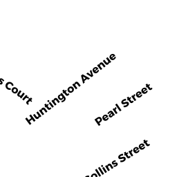
19 PEARL ST
Owner Information
PICANCO JUSTIN D
19 PEARL ST
AMESBURY, MA None


Property Details
19 PEARL ST is classified as a Two-Family Residential (Family duplex).
The primary structure on this property was built in 1930. There are 4,715ft2 of built area within this property. There is 2,381ft2 of residential/living space within this property. This property is listed as having 12 rooms.
19 PEARL ST is valued at $401,900. The land is valued at $140,200 and the structures are valued at $248,000. There is an additional valuation of $13,700 on this property.
This property is in Zone R8. Confirm with local Zoning Board authorities to ensure there are no overlays or other easements on this property.
The most recent deed for 19 PEARL ST is recorded at the local registrar in Book 33534, Page 381. 19 PEARL ST was last sold on Wednesday, September 10, 2014 for $250,450.
Assessment data from fiscal year 2022.
Flood Data
According to the FEMA National Flood Hazard Layer, this property does not appear to be in a flood zone. It may also be in an area not yet reviewed. Nonetheless, confirm this information prior to taking any action.
To view the flood hazards around this property, create a FEMA "Firmette" Map of the area around 19 PEARL ST.
Broadband Internet Providers
| Provider | Type | Bandwidth (mbps) | |
|---|---|---|---|
| VSAT Systems, LLC. | Satellite | 2 | 1 |
| Verizon New England Inc. | DSL | 15 | 1 |
| Viasat Inc | Satellite | 100 | 3 |
| GCI Communication Corp. | Satellite | 0 | 0 |
| HughesNet | Satellite | 25 | 3 |
| Comcast | Cable | 1000 | 35 |
Broadband service provider data from December 2020.
Adjacent Properties
- 18 HUNTINGTON AVE
Residential Condominium owned by BERGGREN BARBARA - 16 HUNTINGTON AVE
Other, Open Space owned by BERGGREN BARBARA - 16 HUNTINGTON AVE
Residential Condominium owned by CARMODY ALLEN - 14 HUNTINGTON AVE
Single Family Residential owned by LEVENSON ANTHONY D - 17 PEARL ST
Single Family Residential owned by CASEY JOANNE B - 23 PEARL ST #B
Residential Condominium owned by HADFIELD KIMBERLY - 23 PEARL ST
Other, Open Space owned by MASTER DEED - 23 PEARL ST #A
Residential Condominium owned by SALMON ELISA M - 20 HUNTINGTON AVE
Single Family Residential owned by DIPESA RICHARD P